Photos
Created by Copilot AI and may not be accurate. Awaiting review
| Built | 1940s by Tom Roseby and Stan Bowerman |
| Condition | ★★★☆☆ (intact; remote and rustic) |
| Location | Southern Naas Valley, Namadgi National Park |
| Alternate Names | Horse Gully No.2 Hut |
| 1940s | Constructed by Tom Roseby with help from Stan Bowerman |
| 1950s | Sold to the Curtis family; used for grazing and vegetable plots |
| Present | Standing; accessible via Naas Valley Fire Trail |
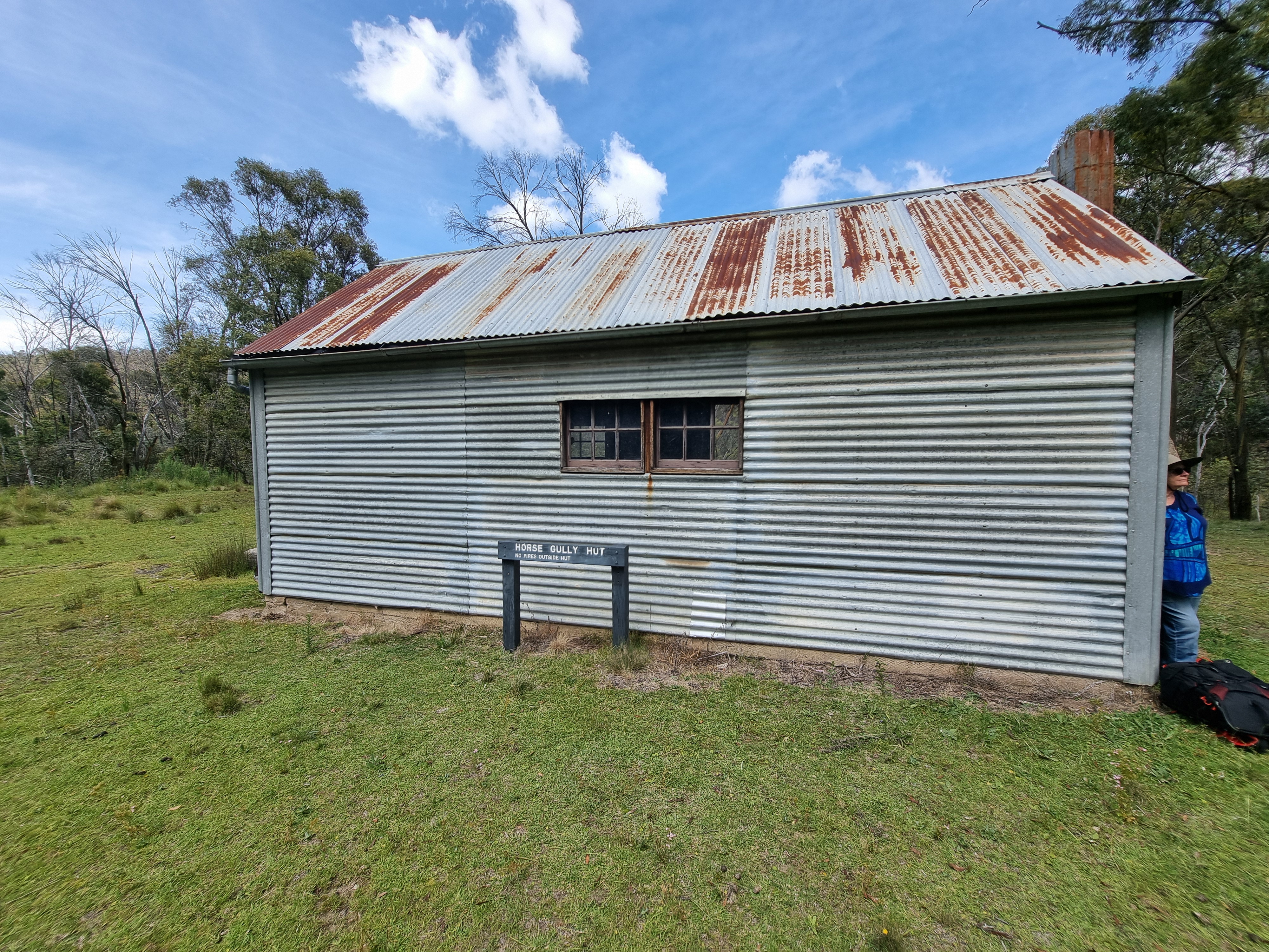
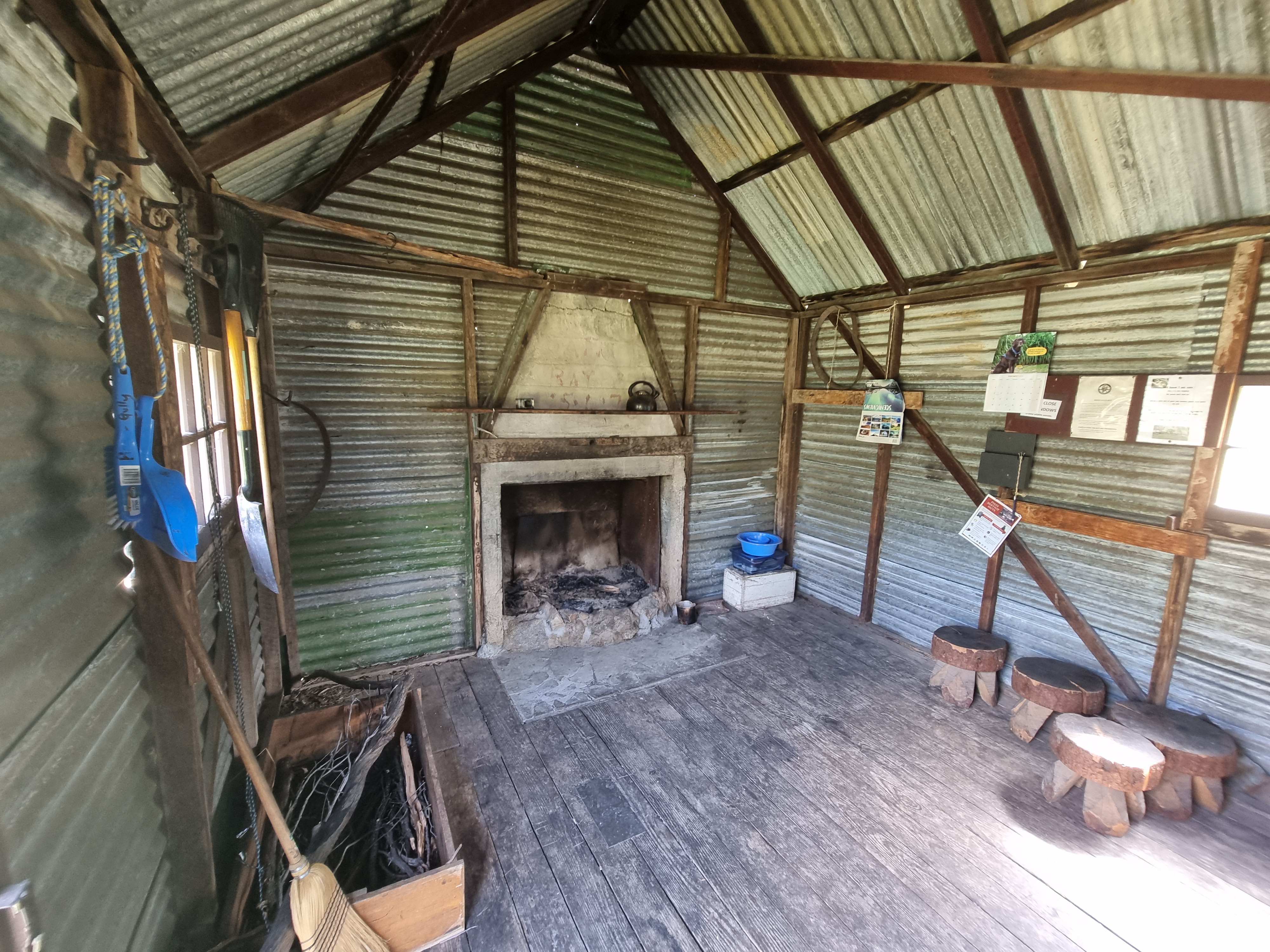
Horse Gully Hut was built in the 1940s by Tom Roseby with assistance from Stan Bowerman. It supported grazing operations and was also used to grow oats and vegetables in the small cleared flat nearby. The hut was later sold to the Curtis family, who continued to use it for pastoral purposes.
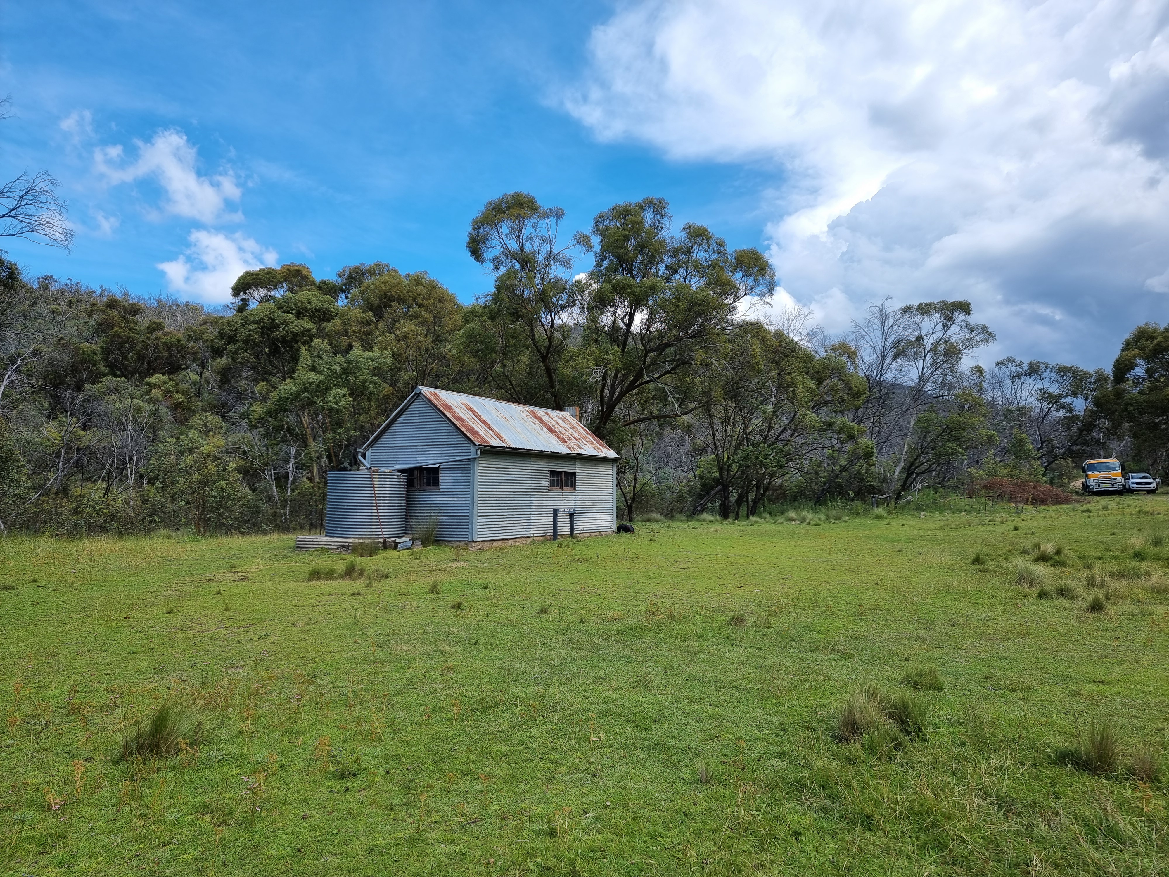
Today, the hut sits quietly in the southern Naas Valley and is a waypoint on the Bicentennial National Trail. It’s accessible via a 17 km return hike from Mount Clear Campground, with creek crossings and undulating terrain.
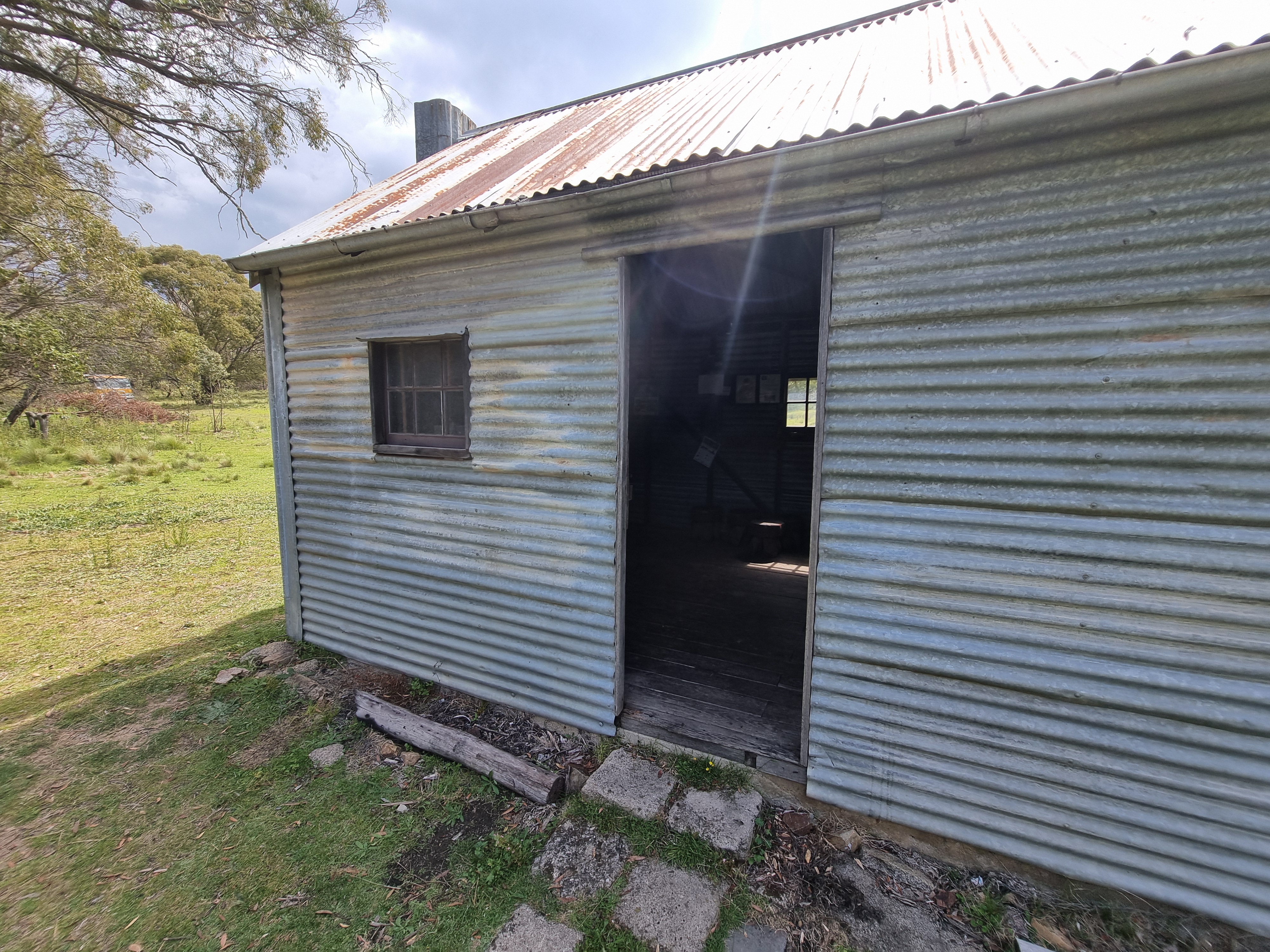
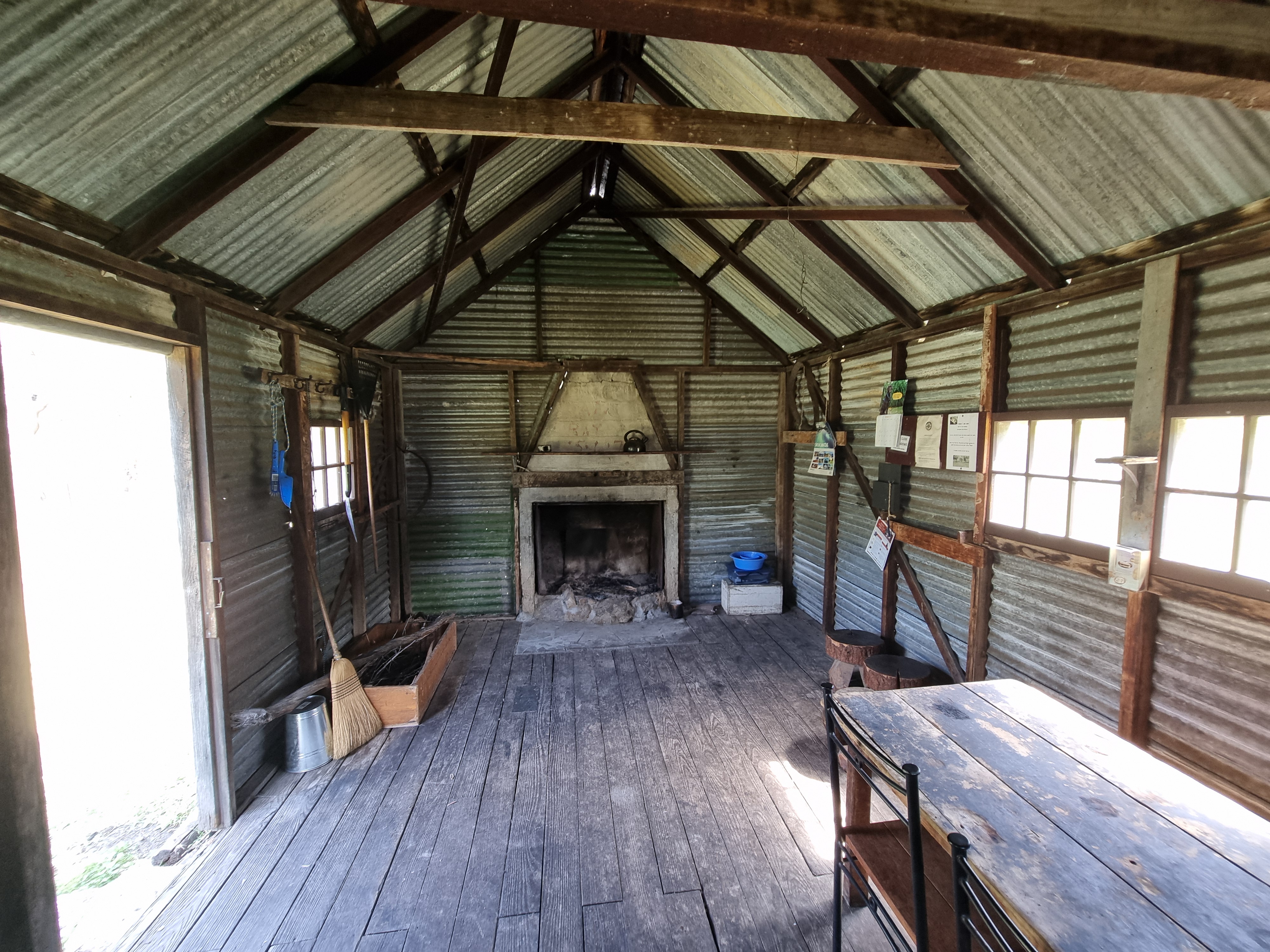
The hut is built of corrugated iron over a timber frame, with a concrete fireplace and iron flue. It has a single room and no internal lining. The floor is earthen, and the structure is weatherproof but basic.
No toilet or water source is present. Visitors must be self-sufficient and prepared for remote conditions.
Horse Gully Hut is listed in the KHA Namadgi register and holds reference number 117383. It is not formally allocated to a caretaker group but is monitored by ACT Parks and KHA volunteers. The site is valued for its grazing history and remote character.
The hut is informally maintained and accessible via the Naas Valley Fire Trail. Interpretive signage is recommended to highlight its grazing origins, construction story, and role in the Bicentennial National Trail. Visitors should log their walk at Mount Clear Campground before setting off.