Photos
| Built | Circa 1940 by Mr. Freebody |
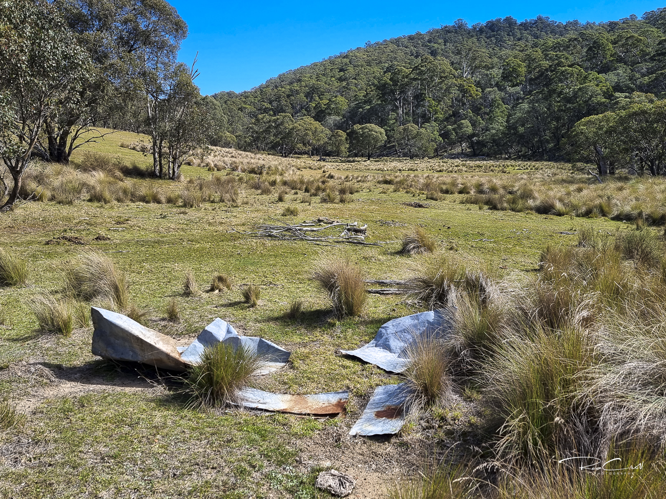
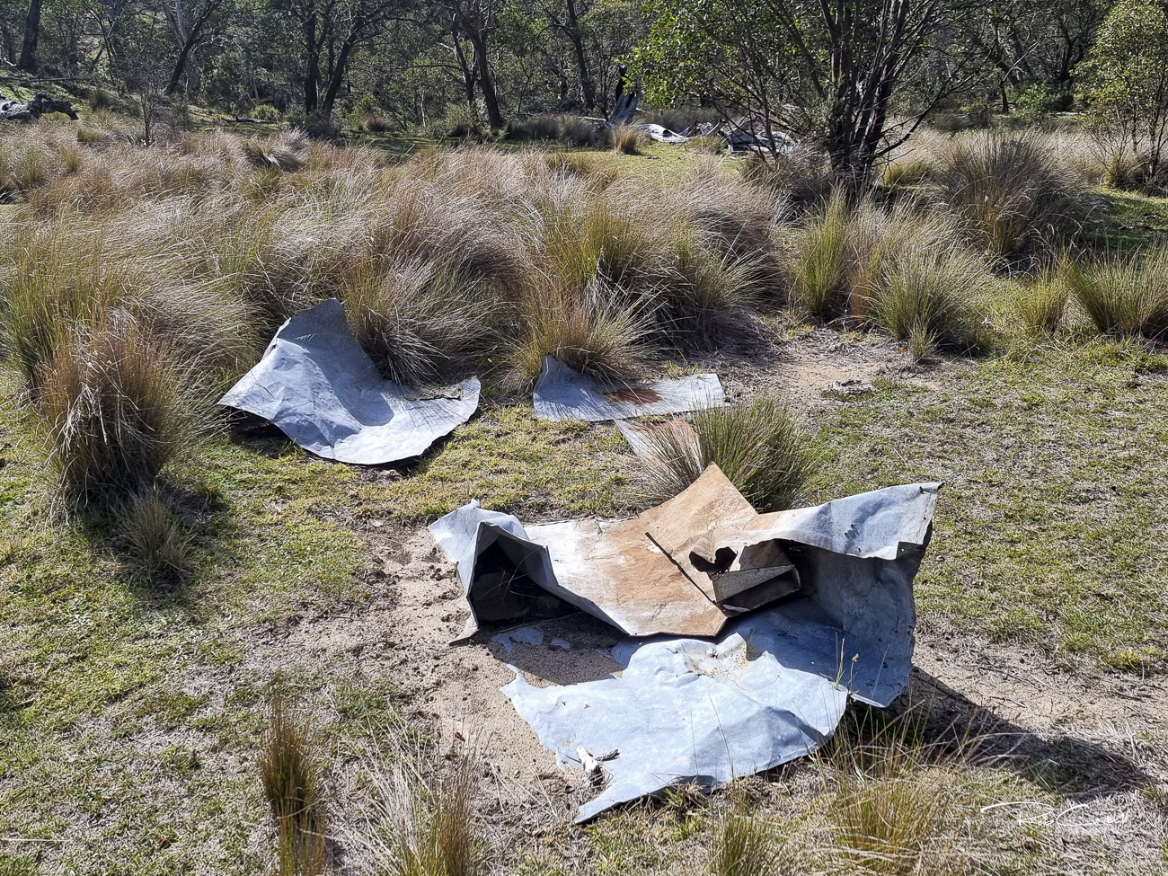
| Condition | ★☆☆☆☆ (collapsed; site only) |
| Location | Tin Mines Fire Trail, 2 km north of Ingeegoodbee Hut |
| Alternate Names | Freebody’s Hut, Freebodies Hut |
| 1940 | Constructed by Mr. Freebody for grazing and horse roping |
| 1950s–60s | Used seasonally; yards built between here and Bill’s Garden |
| Early 1970s | Collapsed; remnants remain on site |
| Present | Site only |
Freebodys Hut was built around 1940 by Mr. Freebody to support grazing and horse roping activities on the plains near the Tin Mines Fire Trail in Kosciuszko National Park. Located approximately 2 km north of Ingeegoodbee Hut and Bill’s Garden, the site was part of a network of pastoral infrastructure used during the final phase of high-country grazing in the region.
By the early 1970s, Freebodys Hut had collapsed, but remnants of the original materials still exist on site. The surrounding area also contains old stockyards between Freebodys and Bill’s Garden, reinforcing its role in pastoral operations.
The hut was built using bush poles and reportedly had fibro walls, though these are no longer visible. The roof consisted of flat tin sheets, likely salvaged from cans or storage containers. Historical photographs suggest both the roof and walls were clad in iron, with a possible timber floor.
No standing structure remains, but sufficient material exists on site to guide a historically accurate rebuild.
PAT FREEBODY INTERVIEWED BY KLAUS HUENEKE 5 July 1984 2
KH: This is the old site, what is known as Freebody's hut?
PF: Well no, it was on this side of the river, the left side of the river where they lived at that time, where the Freebody brothers lived. The old hut on the other side, what they call Freebody's hut these days, Carter Iived there, at that time. Him and a mate of his, I think a fellow named Bryant from Delegate. So they complained that they didn't like polluted water where they were picking up the water for their hut, where they were living. He resented any intrusion at all like that, he had a self-centred way, that's the way he wanted it done, thats the way it would be done.
KH: Was he squatting there or was he on their land?
PF: He had some rights there, he had a lease I think. Actually where the hut was I think was on freehold land, he had a small freehold block where the old hut was, he had title to that at the time...
Dick Power of Berridale on 22nd October 1981 3
KH: The Freebody s and Charlie were sort of at loggerheads for a long time. Do you know how it all started at all, why didn't they like each other?
DP: No, but there was a big court case.
KH: I know, they planted skins on each other or something.
DP: The story I know is that Charlie Carter lost his horse and found it was shot, and he had Freebody charged. He was brought into Jindabyne and came up before the court. It wasn't Carter's horse at all, it was their own horse. He told the judge they took the skin off, they told him it was their business, not his. Charlie Carter went to prison for three years I think, I don't know, but I can't tell you that for certain.
DAVE & NEEN PENDERGAST and KEN KIDMAN by Klaus Hueneke, 22 October 1981 4
DP: The old hut that they built there then, I think part of it is in this one now, they packed it from Tin Mine, that was part of the Tin Mine, Jacky Freebody and Don Vincent.
KH: The old hut?
DP: That one that's there now. They built another tin hut along side where the old one burnt down.
The site is monitored informally by NPWS and heritage walkers. No active stewardship is in place. Interpretive signage could highlight its role in alpine grazing and bush construction.