Photos

Created by Copilot AI and may not be accurate. Awaiting review
| Built | 1950s (rebuilt after 2007 bushfire) |
| Condition | ★★★★☆ (rebuilt; weatherproof and accessible) |
| Location | Alpine National Park, VIC – Bluff Track near Mt Buller |
| Alternate Names | None recorded |
| 1950s | Original Bluff Hut constructed for cattlemen and bushwalkers |
| 2007 | Destroyed in bushfires; rebuilt with community support |
| Present | Used by hikers, 4WDers, and campers; seasonal access only |
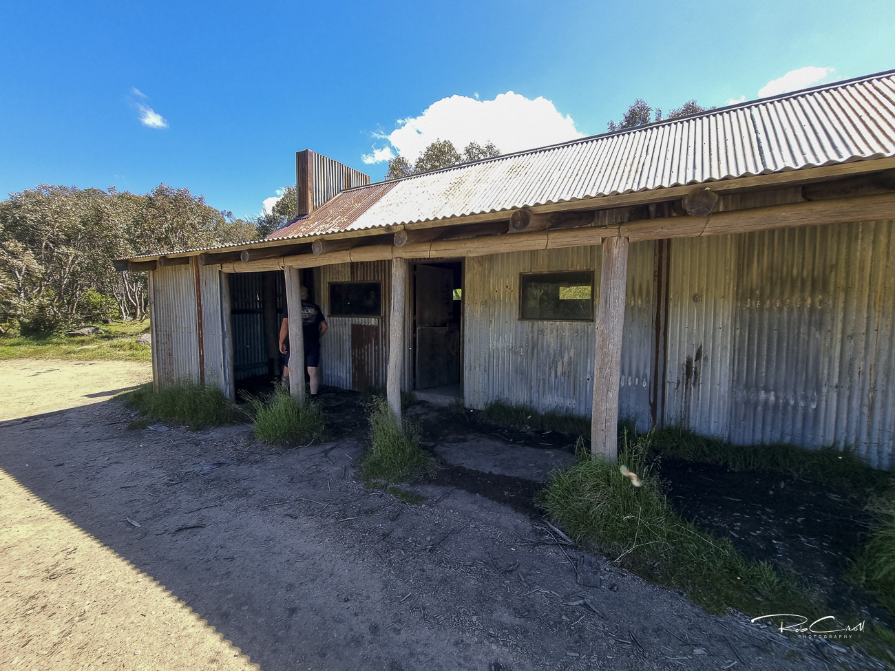
Bluff Hut was originally built in the 1950s to support cattle grazing and provide shelter for bushwalkers traversing the Bluff and Howitt High Plains. It stood for over 50 years before being destroyed in the 2007 bushfires. The hut was rebuilt with support from Parks Victoria and local volunteers, preserving its role as a key alpine refuge.
Today, Bluff Hut is one of the highest huts in Australia and offers panoramic views of the surrounding ranges. It’s a popular stop for 4WD tours and multi-day hikes, especially along the Bluff–Lovicks–Howitt circuit.
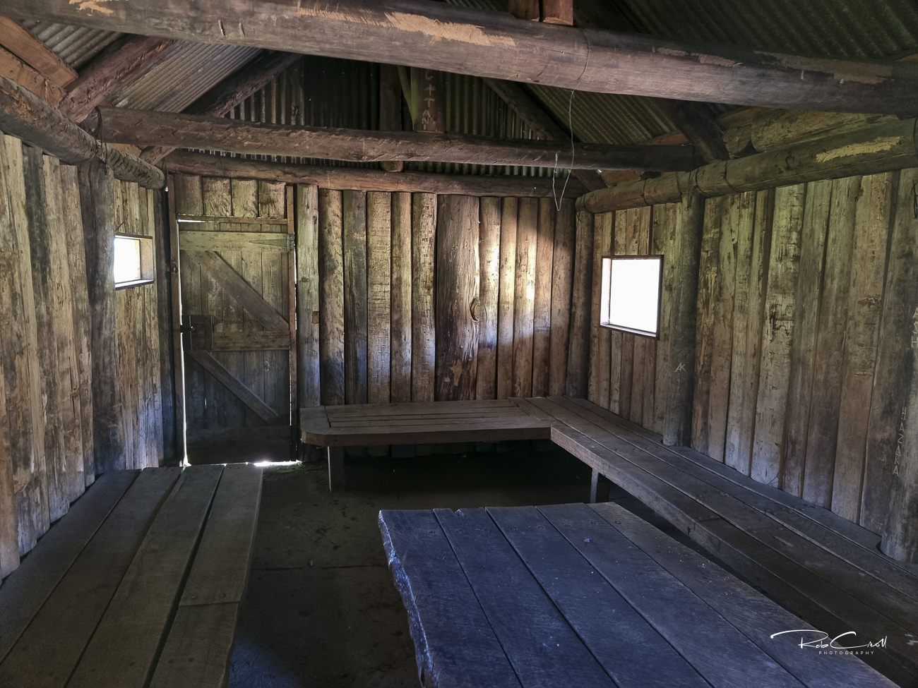
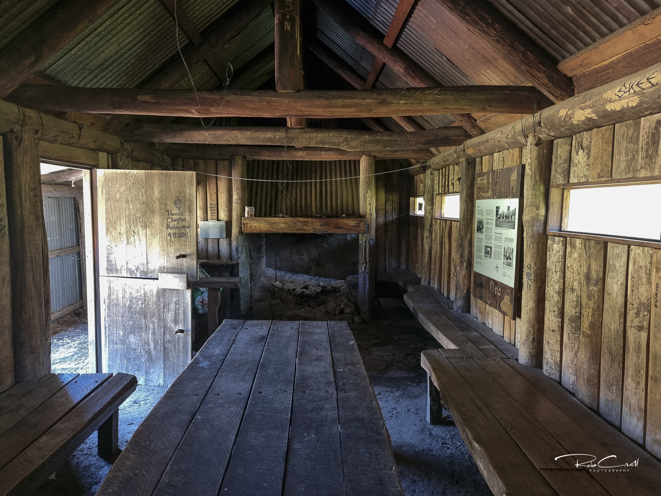
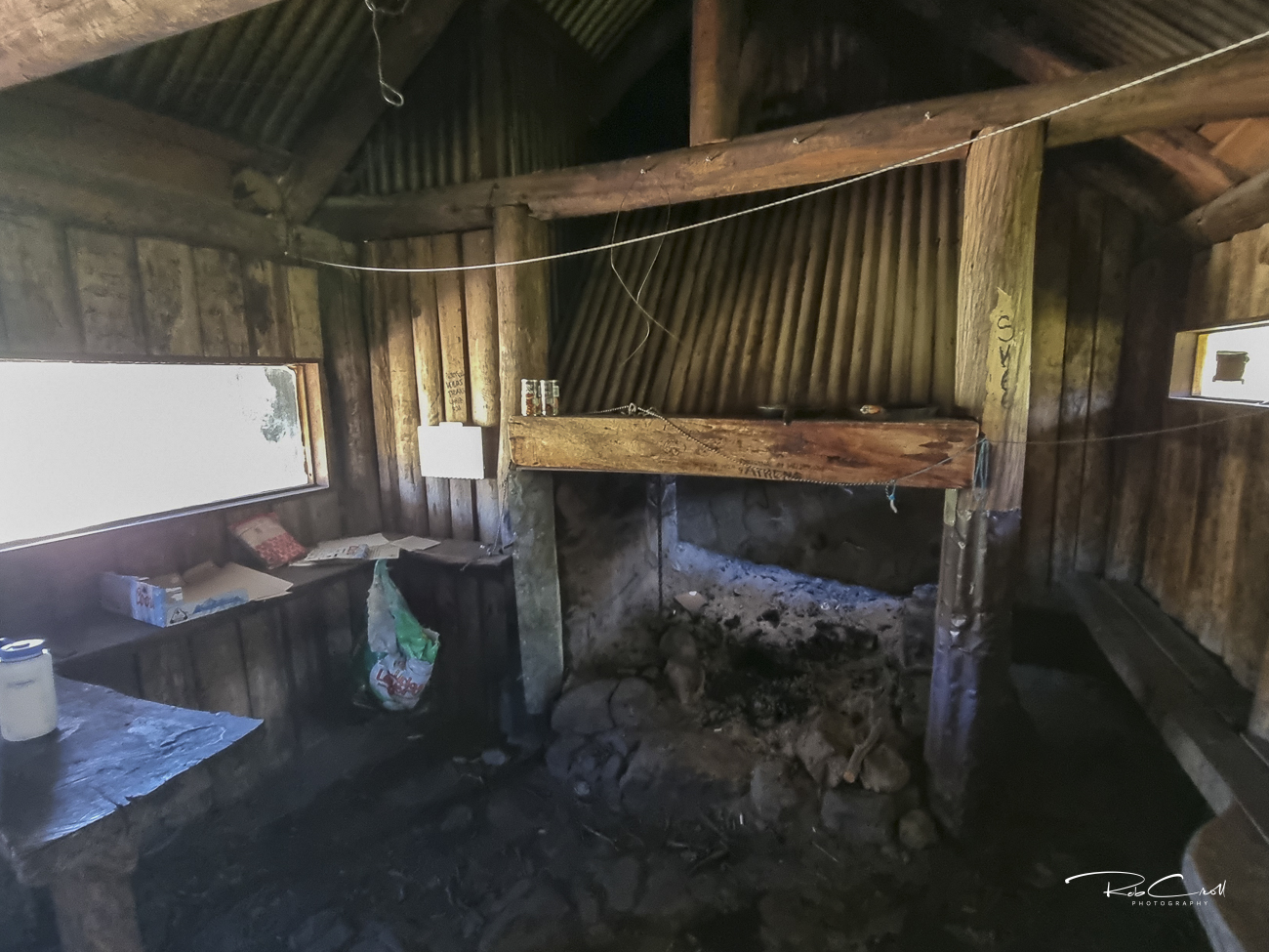
The rebuilt Bluff Hut is a timber-framed structure clad in corrugated iron, with a stone fireplace, wooden floor, and covered verandah. It includes basic furnishings and a pit toilet nearby. The hut is dry, weatherproof, and suitable for emergency shelter or day use.
Access is via Bluff Track, which is seasonally closed from June to November due to snow and erosion risk.
Bluff Hut is managed by Parks Victoria and maintained with support from local volunteers. It is part of the Alpine National Park’s cultural heritage network and is protected under bushfire recovery and alpine access guidelines. Seasonal closures apply to Bluff Track and surrounding routes.
Visitors are encouraged to respect the hut’s remote setting and pack out all waste. Interpretive signage is recommended to highlight its bushfire recovery story and alpine grazing legacy. Access requires a high-clearance 4WD or multi-day hike from Howitt Plains or Bindaree Road.